
LA CARTOGRAFÍA HISTÓRICA INTERACTIVA COMO DISPOSITIVO ESTÉTICO PARA ACCEDER AL CONOCIMIENTO DEL PAISAJE. CASO PRÁCTICO: LA ACEQUIA RASCAÑA
María José Gutiérrez
Universitat Politècnica de València
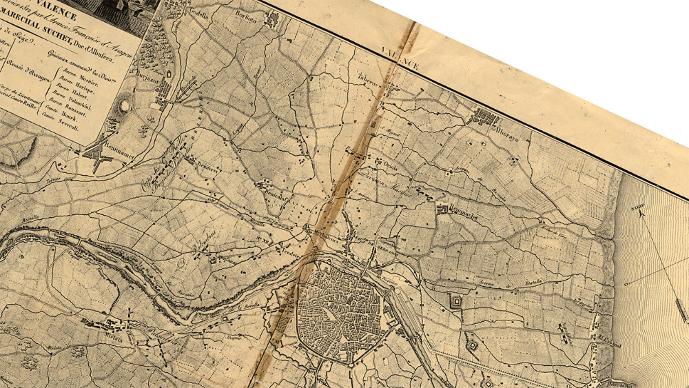
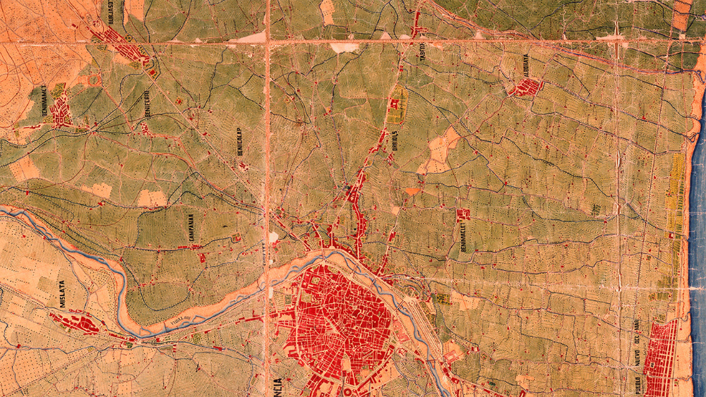
En la geografía moderna tuvo lugar el desarrollo de los mapas temáticos y como consecuencia, la maduración de la cartografía cualitativa, donde la psique fue clave en su interpretación. En este contexto, la asociación de factores perceptivos y psicológicos tuvo sus consecuencias en el ámbito de las artes. De ahí, el concepto del espacio empieza a formular una visión estética, múltiple y polisémica. El territorio se convierte en el resultado de nuestra intervención en el espacio, tanto como colectivo en sociedad, como a nivel individual. Estas relaciones quedaban representadas con un lenguaje gráfico sintético en los mapas cartográficos. Con la pretensión de experimentar con las diferentes interpretaciones del territorio, hemos desarrollado una aplicación interactiva que visualiza y contrapone cuatro mapas históricos sobre el paisaje que recorre la acequia de la Rascaña, una de las ocho acequias que componían el entramado de la ciudad de Valencia y sus alrededores.
Abstract
In modern geography it took place the development of thematic maps and as a consequence, the maturation of qualitative cartography, where the psyche was key in its interpretation. In this context, the association of perceptive and psychological factors had its consequences in the field of the arts. From there, the concept of space begins to formulate an aesthetic, multiple and polysemic view. The territory becomes the result of our intervention in space, both as a collective in society, and at the individual level. These relations were represented with a synthetic graphic language in the cartographic maps. With the aim of experimenting with the different interpretations of the territory, we have developed an interactive application that visualizes and contrasts four historical maps about the landscape that runs along the Rascaña irrigation canal, one of the eight canals that formed the layout of the city of Valencia and its surroundings.
Key Words
Rascaña irrigation canal, historical cartography, synthetic graphic, interpretation of landscape.
Artículos Relacionados
-
Nolstalgiómetros. Libros de artista, ensayo visual sobre los cambios en el entorno
Elba Ireri Topete CamachoGuadalupe María Gómez Basulto
-
La quirografía en el Libro-Arte latinoamericano: explorando la escritura como expresión artística
Rafael Morales Cendejas
-

«Libro en Blanco». Espacios liminales de la gráfica contemporánea: Una propuesta de metodología creativa de aplicación de la investigación a la docencia a través del libro de artista
Ana Soler BaenaAntía Iglesias Fernández
-
El Taller: lenguaje y práctica experimental
Carlos TorralbaRoxana Cámara


Revista Sonda: Investigación en Artes y Letras Anuncio © 2017 ISSN: 2254-6073